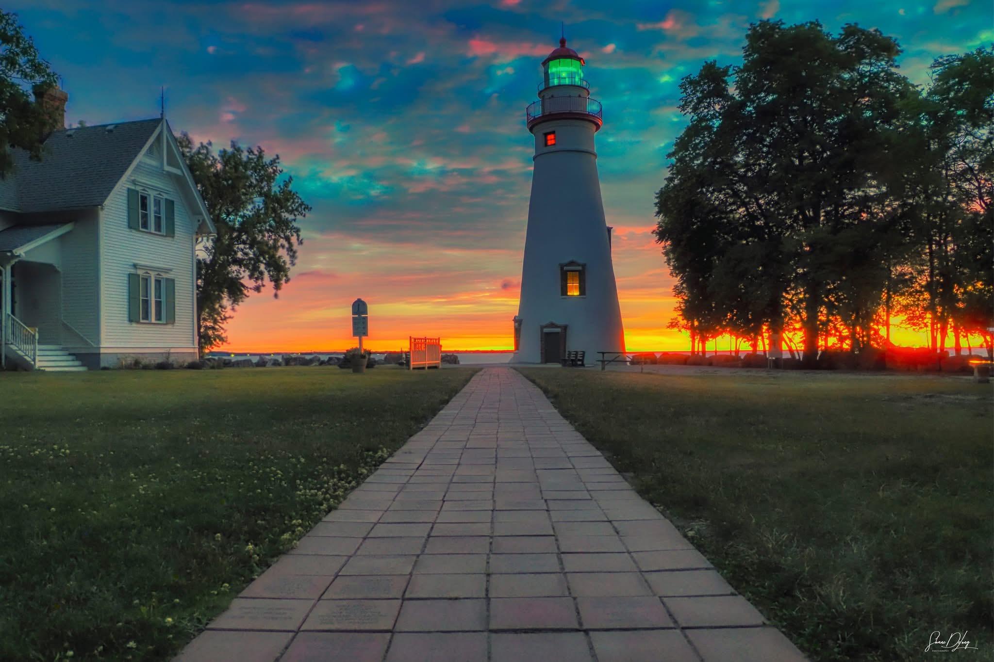
Dawn at Ohio’s Marblehead Lighthouse and Museum on Lake Erie, 4 March, 2025. Photo by Shane DeLong Photography.
#LighthousesOfMastodon
#GreatLakes
#LakeErie

Dawn at Ohio’s Marblehead Lighthouse and Museum on Lake Erie, 4 March, 2025. Photo by Shane DeLong Photography.
#LighthousesOfMastodon
#GreatLakes
#LakeErie
From my unsuccessful comet hunting attempt a couple nights ago, I watched a Bald Eagle hunt fish for a bit before taking off to go roost for the evening. I’ve seen this species go from being extirpated locally when I was a kid to a regular breeder now.
#birds #eagles #conservation #LakeErie
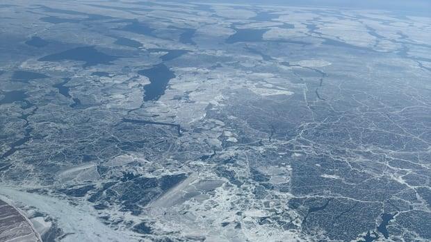
Lake Erie had 95% ice cover this winter. What it means for the environment
Scientists say ice helps combat erosion, lake effect snow and algal blooms, and impact water levels.
#weather #environment #science #LakeErie #News #Canada
https://www.cbc.ca/news/canada/windsor/lake-erie-ice-peaked-95-per-cent-1.7467734?cmp=rss
A helpful interactive tool for your #GBBC2025: Simple photo ID guide that is the most useful for #Canadian #Birds, check it out & see what should be in your area.
Find it at birdscanada.org -- discover birds -- new to birding
https://www.naturecounts.ca/apps/checklist/index.jsp
Photos here are for the #BirdsCanada HQ on the north shore of #LakeErie #GBBC
 Photos: Mark Peck and Christian Artuso. Species are Canada Goose, Mute Swan, Tundra Swan, Mallard male, Mallard female, American Black Duck, Redhead male, Redhead female, Bufflehead male, Common Goldeneye female, Common Merganser male/female, Rock Pigeon, Mourning Dove, Sandhill Crane, Sanderling, Ring-billed Gull, American Herring Gull, Bald Eagle, Red-tailed Hawk, Red-bellied Woodpecker, Downy Woodpecker male, Downy Woodpecker female, Hairy Woodpecker male, Hairy Woodpecker female, Pileated Woodpecker")

28 seconds of silent #sunrise over a frozen (very very cold) lake this morning because it's helping me keep my blood pressure down to "probably my veins won't explode" levels.
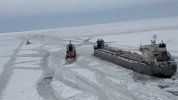
Ice-bound Canadian ship with 17 people on board no longer stuck in frozen Lake Erie
A freighter was on its way to Canada on Sunday after it was freed from ice that trapped it in a frozen Lake Erie for days, the U.S. Coast Guard said.
#rescue #shipping #weather #LakeErie #Canada #News
https://www.cbc.ca/news/canada/windsor/freighter-trapped-ice-lake-erie-freed-1.7441945?cmp=rss
Just a quick edit from my phone from the #wedding I shot yesterday. It was frigid by the lake with the wind even though it was a heat wave at 30 degrees comparatively from the past week. The couple had a few specific spots they wanted in Bay Village and this was one of them. They had this location in mind near a kayak put-in location, it was pretty icy but they made it to the shore with no incidents.
.
.
#cleveland #portraits #photography #lakeerie #snow #ice #frozen #weddingphotography

From my unsuccessful comet hunting attempt a couple nights ago, I watched a Bald Eagle hunt fish for a bit before taking off to go roost for the evening. I’ve seen this species go from being extirpated locally when I was a kid to a regular breeder now.
#birds #eagles #conservation #LakeErie
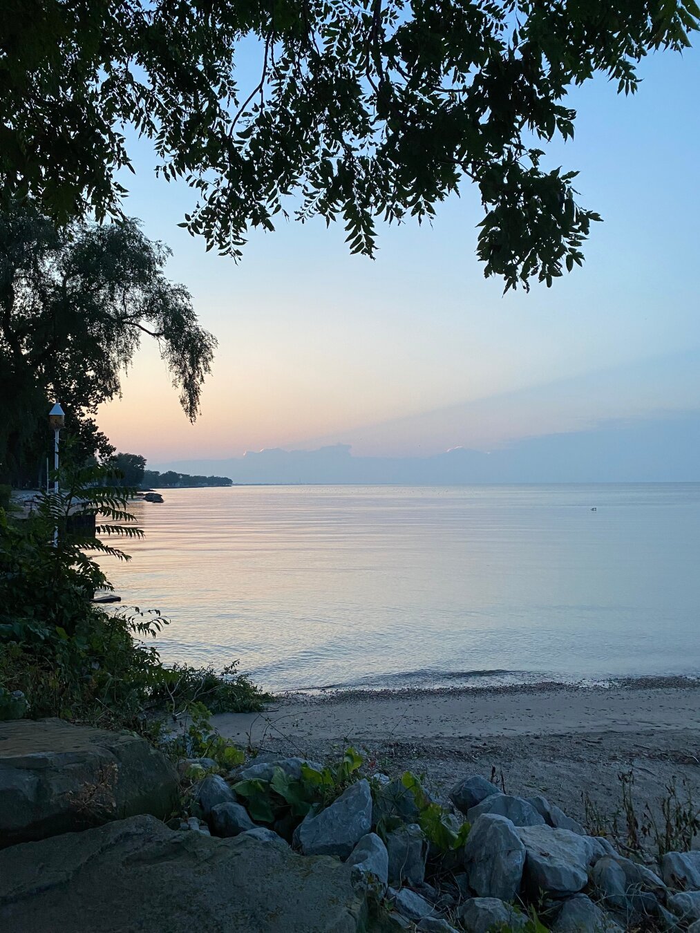
This morning at my local beach. I was too late to catch the gorgeous sunrise, but this view is always interesting to me. Always.

"When cyanobacteria proliferate out of control, they can form clouds of green algae called cyanobacterial harmful algal blooms. Some types of cyanobacteria produce toxins, & so these algal blooms can not only be harmful to wildlife & livestock, but to people using the water as well. The Winam Gulf of Kenya's Lake Victoria, a gulf with similar limnological properties & therefore could potentially be a model for Lake Erie in a warming climate".
#globalwarming #LakeErie
https://phys.org/news/2025-01-kenya-lake-victoria-cyanobacteria-erie.html


I’m not sure how this works or how to post an about me but here I am.
My name is axton.
I’m 33 years old and ftm.
I work in healthcare and own a small shop
I sell witchy things, readings, jewelry, sprays, rocks, fossils, a decor, and more.


Winter sunrise at Ohio’s Marblehead Light on Lake Erie. Photo by Mark Shutt.
#LighthousesOfMastodon
##GreatLakes
#LakeErie
#Sunrise
#SilentSunday

At least 30 inches had fallen in several places in Michigan’s Upper Peninsula and along Lake Erie’s shore in northern Pennsylvania and western New York, the National Weather Service said Saturday.
#Blizzard #Ohio #Michigan #Pennsylvania #NewYork #weather #GreatLakes #LakeErie #LakeOntario
https://www.washingtonpost.com/weather/2024/11/30/lake-effect-snow-storm-erie/
The Great Lakes Ranked By Size
--
https://www.worldatlas.com/lakes/the-great-lakes-ranked-by-size.html <-- shared article
--
“The Great Lakes is a series of five interconnected freshwater lakes that span Canada and the United States. The five lakes, Lake Superior, Lake Huron, Lake Michigan, Lake Erie, and Lake Ontario, hold 21% of the Earth’s freshwater, spanning 94,250 square miles and holding 5,439 cubic miles of water. These vast lakes formed approximately 14,000 years ago due to climate warming and glacial melting…”
#GIS #spatial #mapping #GreatLakes #hydrology #freshwater #lake #Canada #USA #LakeSuperior #LakeHuron #LakeMichigan #LakeErie #LakeOntario #waterresources #navigation #geography #metrics